|
United States Map(Google Map) Now, Map data loading ..... (If the map is not displayed, There is a possibility to be able to display by permitting JavaScript.) |
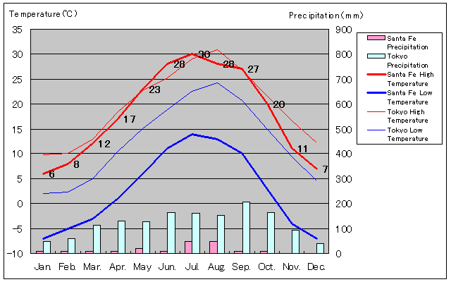
| Month | Jan | Feb | Mar | Apr | May | Jun | Jul | Aug | Sep | Oct | Nov | Dec |
| Average High Temperature (°C) | 6 | 8 | 12 | 17 | 23 | 28 | 30 | 28 | 27 | 20 | 11 | 7 |
| Average Low Temperature (°C) | -7 | -5 | -3 | 1 | 6 | 11 | 14 | 13 | 10 | 3 | -4 | -7 |
| Average Precipitation (mm) | 10 | 10 | 10 | 10 | 20 | 10 | 50 | 50 | 10 | 10 | 0 | 0 |
| Rainy Days | 2 | 1 | 1 | 1 | 2 | 1 | 5 | 5 | 1 | 1 | 1 | 1 |